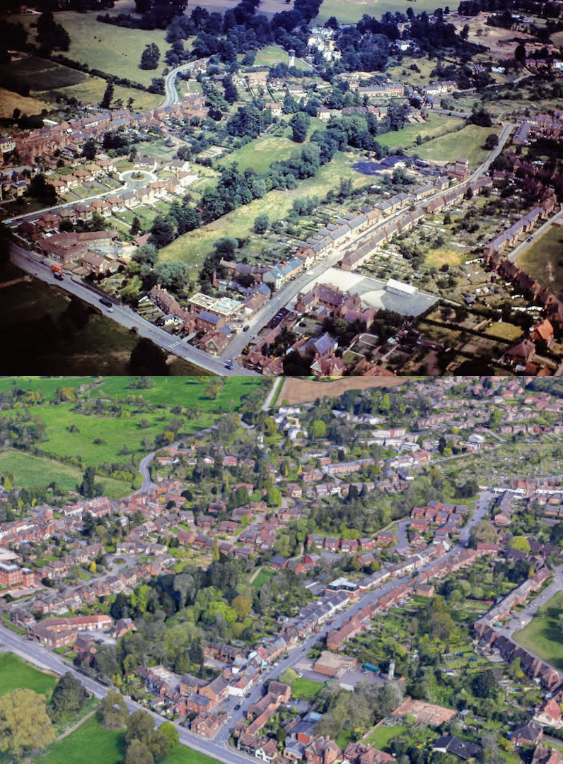
The photo above comes once again from the aerial imagery snapped by the late John Webster, kindly provided to us by his son Steve Webster, now living in New Zealand. This fantastic aerial photo of the School Lane area shows many seldom photographed features which have now been lost, or substantially altered, since the ‘then’ image was taken. The ‘now’ image is taken once again from the 3D photogrammetry view on Google Maps.
These images are taken from the skies over Abbey Hill, looking north over School Lane and Pears Close. At the junction of School Lane we can see the light-industrial units on the site now occupied by the Rosemary Mews residential development, built in 1987. Opposite, we can see that the flats known as Avon Court are under construction, up against the timber framed backs of the cottages on Rosemary Hill.
Proceeding north-east up School Lane we can see an excellent shot of the site of the old school buildings, which occupied what is now the lawn beside the fire station, and its playground yard where the fire station itself now stands. It’s very rare to find images of the old school, so this is a particularly valuable image. The school subsequently moved to its present site on The Blundells in the early 1930s.
Further still up School Lane, we can see the old farm house, demolished in May 1977 and now occupied by the residential Prescelly Court flats. Beyond that, we can see the old houses known as Noah’s Ark, demolished in 1965, and now occupied by the houses besides the School Lane Fish & Chip Shop. Beyond that there were no buildings, as that end of School Lane was occupied by the mill leet that ran beside the road, crossing under the Manor Road bridge, along The Close and ultimately to power the old Oil & Cake mill at Mill End.
Elsewhere, we can see that the old J.C. Clarke’s Wheelwrights on Bridge Street has already been demolished and replaced by the time the image was taken, so that dates the aerial image as being taken after 1961 and before 1965 when Noah’s Ark was demolished.
Robin Leach has also added some observations: “Note the coal yard behind Noah’s Ark, not sure if it was Kelsey’s or Ragg’s at this time; it also had stables. Tainters Hill common still an open space.”
We’d like to thank Steve Webster for providing this image, and many others, for us to use. Also, thanks to Robin Leach for adding his observations. Thanks, too, to Anthony Manning for pointing out an error, which has now been corrected above.
Thanks, Chris, for putting this on the website (and so many other things). But, as a resident living beyond the chip shop, I was concerned that “Proceeding north-west up School Lane” should read “Proceeding north-east up School Lane”.
Anthony.
Thanks Anthony, you are indeed correct. I have corrected it to read “Proceeding north-east up School Lane” as you pointed out.