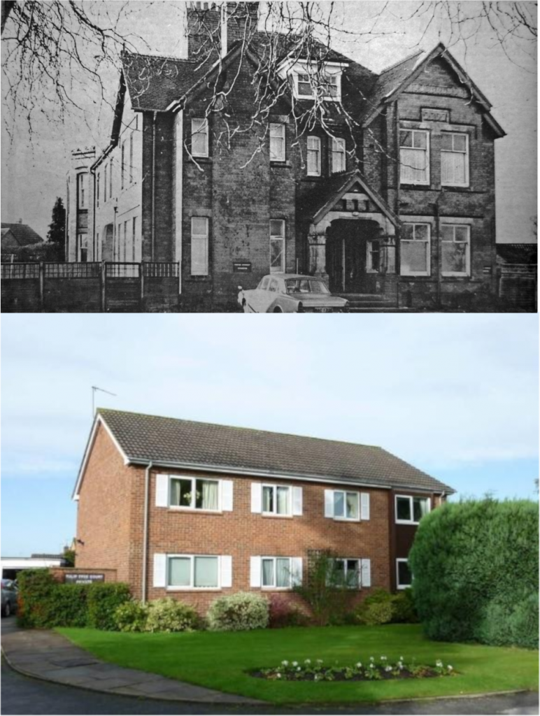
In a recent Then & Now article we showed a comparison of the long demolished house known as Elmdene, courtesy of Joanna Illingworth. In the article, we remarked upon the difficulty in achieving an exact vantage point for the ‘now’ image, due to houses having been built on that spot subsequently, on what is now Tulip Tree Avenue, which was then the drive of the house itself.
After the article was published, we were contacted by Robin Leach, who offered us the alternative ‘then’ image above, which matches Joanna’s ‘now’ vantage point more closely. In Robin’s photograph above, originally sourced from the Kenilworth Weekly News, the house is photographed from the drive, looking almost due westwards. We can see the eastern front porch (right) and also a glimpse of the crenelated southern bay windows (left) overlooking the gardens. The drive followed the same route as the southern half of Tulip Tree Avenue, and joined onto Windy Arbour as it does today. The northern exit of Tulip Tree Avenue onto Whitemoor Road was added when the housing estate was built in 1960.
The name of the house seems to be fairly common for the era. It derives from the Old English tree name Elm plus Dene, meaning “small thickly wooded valley”, from the Old English word denu meaning “valley”.
A map comparison of the house as it appeared on the OS 25 Inch, 1892 – 1914 map, versus a modern satellite image, can be found here.
Thanks to Joanna Illingworth for providing the original ‘then & now’ images and also to Robin Leach for the updated ‘now’ image.