When we left Part Three of this Blacklow Hill ‘From the Archives’ feature it was June 1972 ad the dig had concluded but the official report remained unpublished. The extent to which the dig site would be obliterated by the extension of the Warwick Bypass was at that stage unknown.
Harry Sunley returned to the topic in 1983, in the KHAS publication Account Rendered – 21 Years of Work by the Kenilworth History and Archaeology Society. By this stage the official report of the dig, which had been promised by the authorities leading the dig, had still not been published so Harry attempted to summarise the findings of the dig to put a line under what had been discovered.
The following is taken from Harry’s 1983 Account Rendered piece:
“Blacklow Hill – An Excavation 1971-2
SP 290675
1. Introduction
This account of a major excavation on Blacklow Hill is written more than ten years after the work on site was completed. Surprisingly, no formal report has been written by the archæologists who took over the direction of the site, although it is understood that a summary report may soon appear. However, as the aim of this publication is to give an account of the Society’s activities, our contribution is reported here, based on rough notes and the Society’s Newsletters of the time; some tentative conclusions are also drawn about the site as a whole.
2. Blacklow Hill
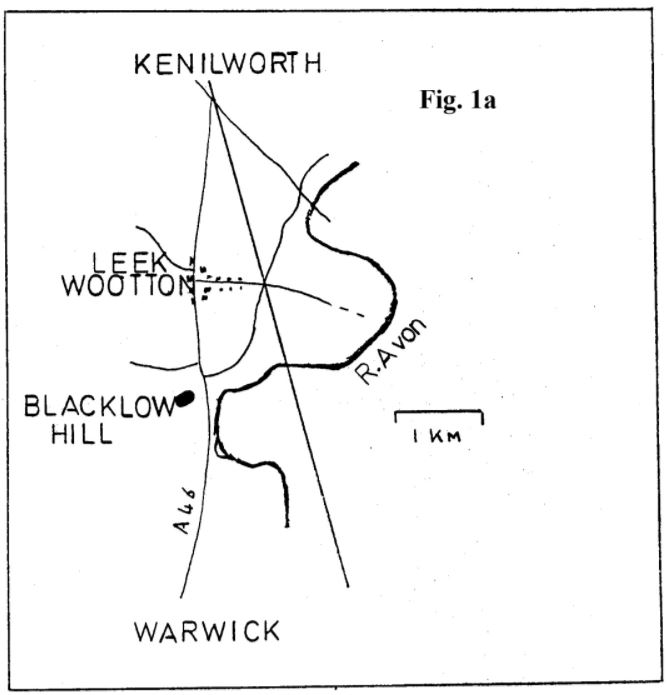
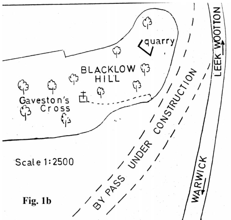
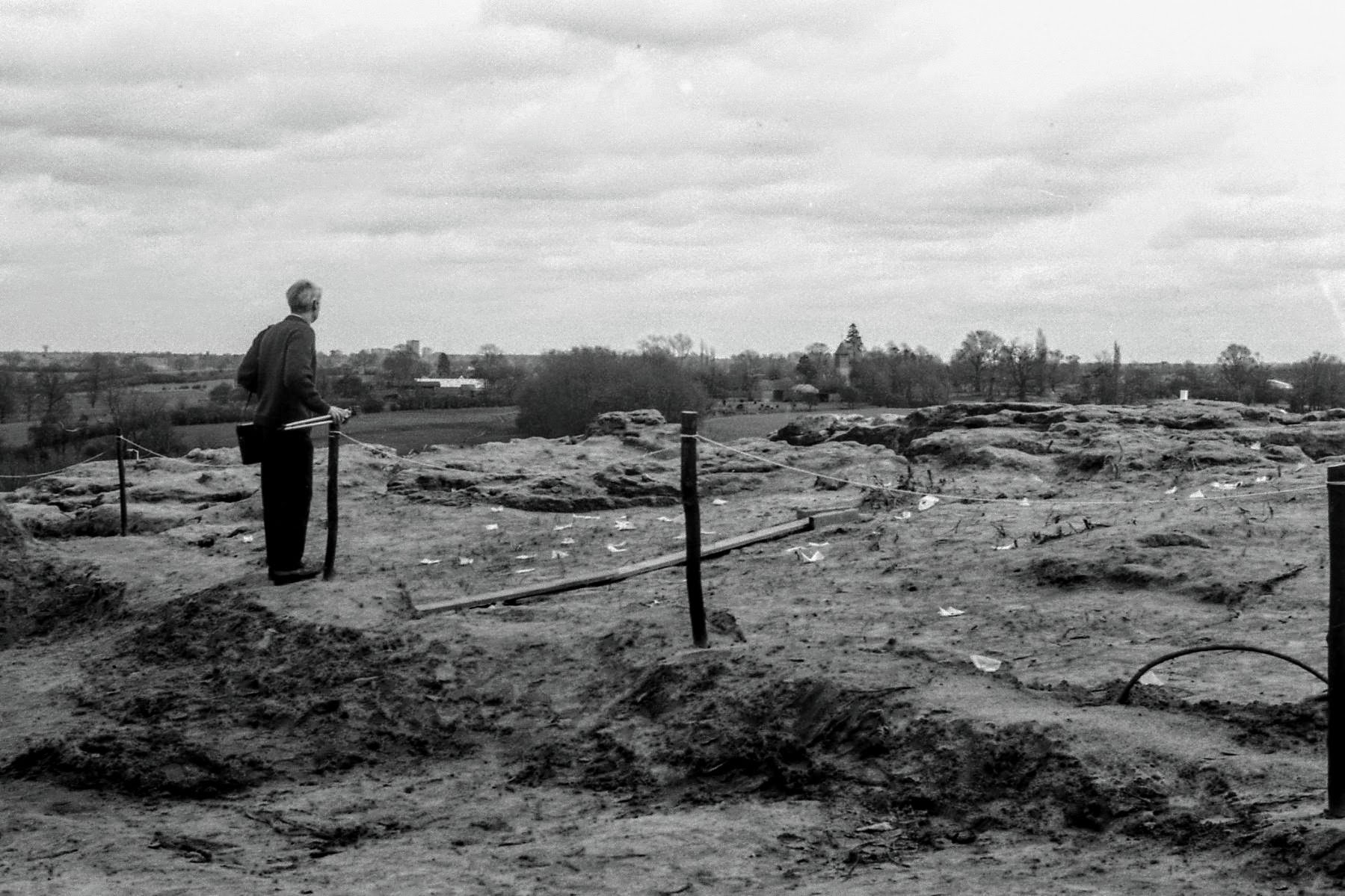
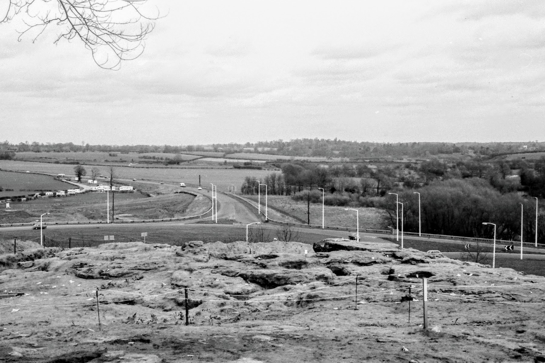
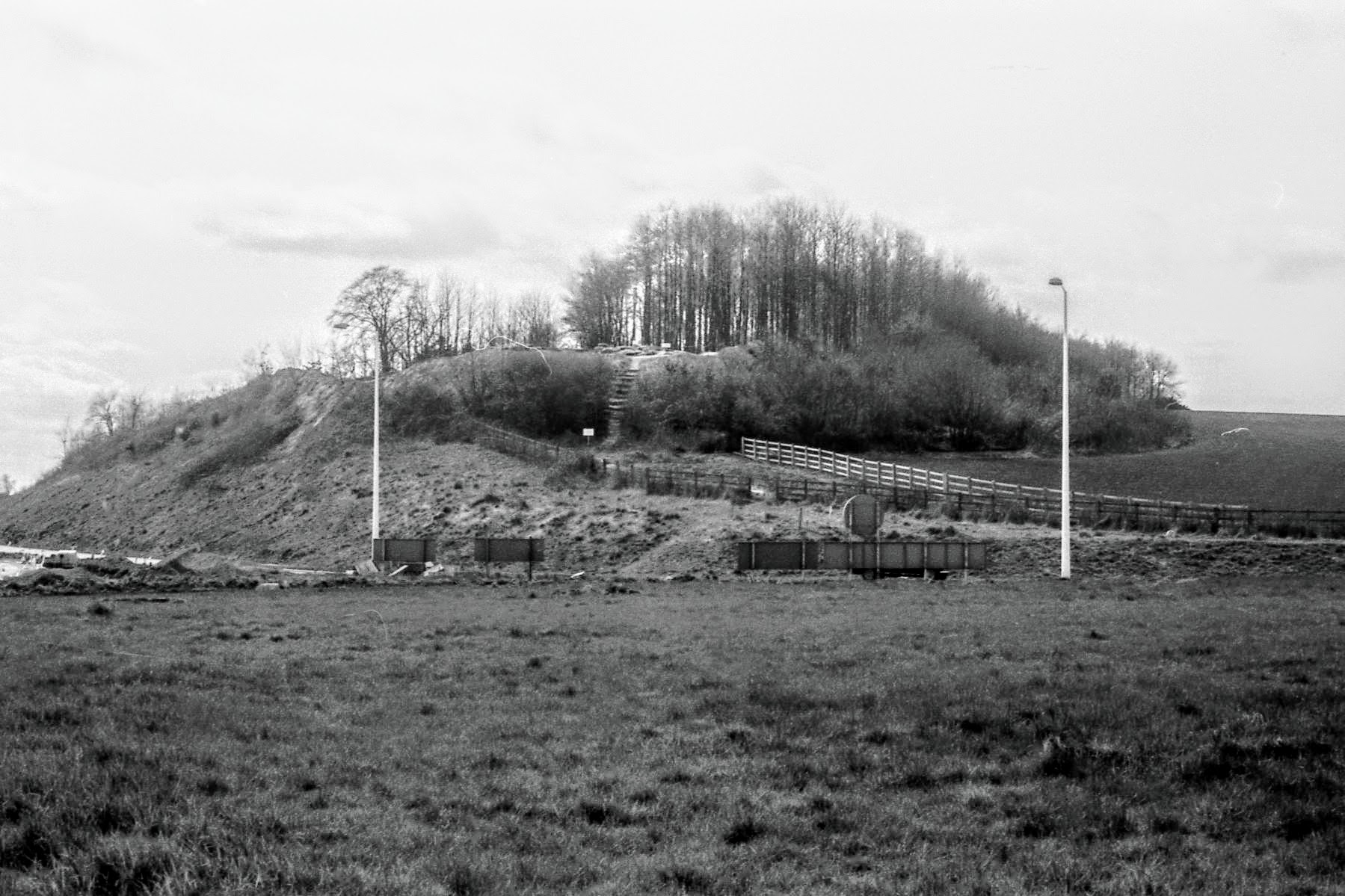
Blacklow Hill lies half a mile south of Leek Wootton at what was the end of the Warwick by-pass. In 1971, with the imminent extension of this to form the Kenilworth by-pass, the area was surveyed by various groups for any archæological features requiring rescue. At Blacklow Hill a possible barrow and some walls hidden in the scrub were reported. Blacklow Hill is a mound rising above the plain of the Avon which runs 150 metres to the east. The land rises sharply to the east and south, but the hill blends in gently with the land to the north except at the eastern end where it can be likened to a promontory. The hill is heavily wooded except for the north east end which was covered in scrub and light trees. Fig.1 shows the location of the site. The hill was the execution site of the unfortunate Piers Gaveston who was beheaded in 1313, and a 19th century memorial cross on the hill marks the event. The name ‘Blacklow’ suggests a burial place.
3. The Excavation
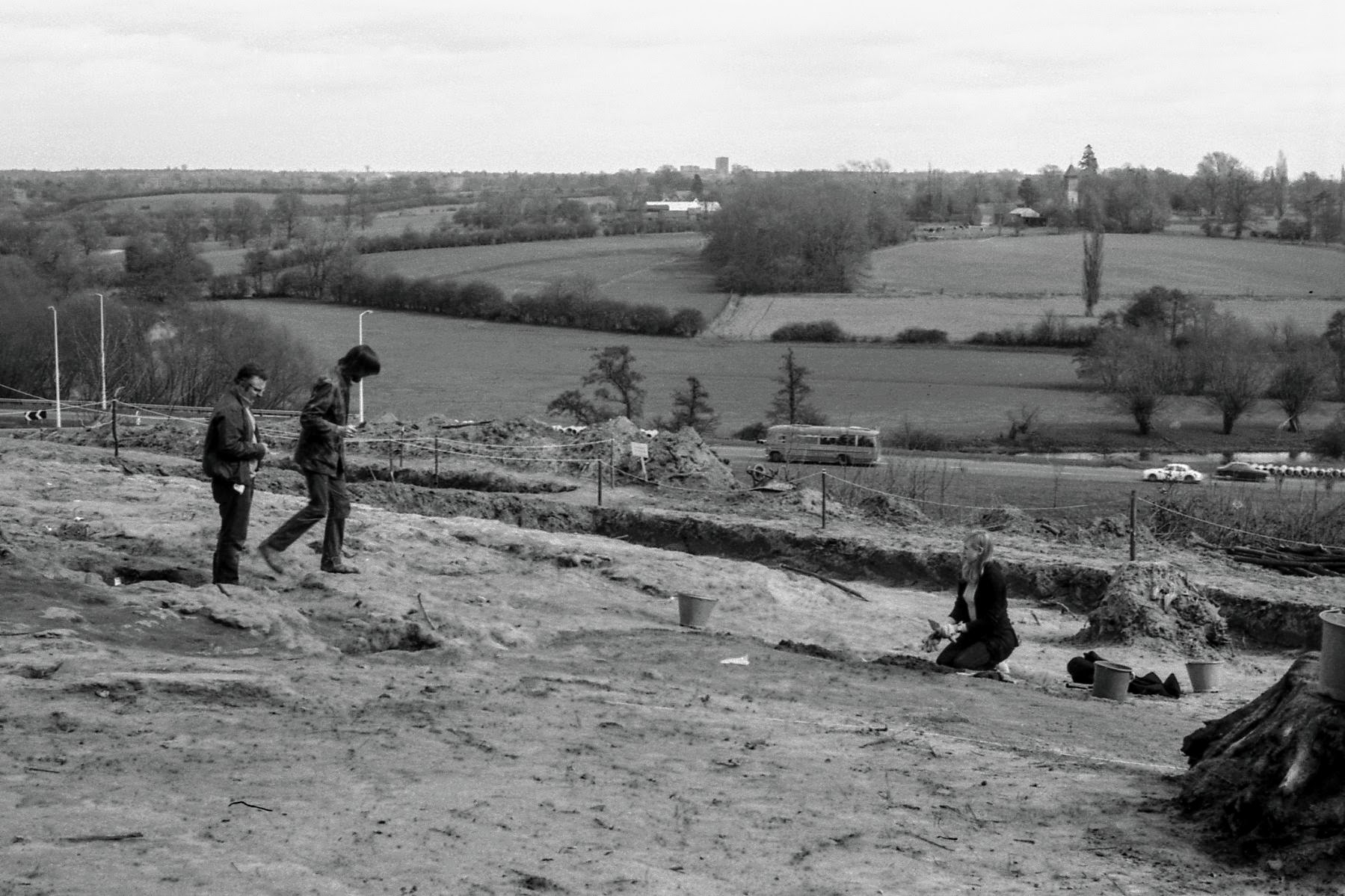
The Society was initially asked by the Warwick County Museum to locate the above-mentioned walls in the scrub, and work started in June 1971. Until November 1971 the Society was the mainstay of effort, although other units operated from time to time. After the first few weeks, the site was under constant threat from the road construction engineers who wished to slice off the south and west of the hill, and each weekend’s work was to be the last. After November 1971 and the discovery of the burials, the full direction was quite properly taken over by the Warwick County Museum through John Hedges and Bill Ford. Full-time workers were brought onto the site, funded by the Department of the Environment. The features of the excavation can be conveniently reported under three headings as below:
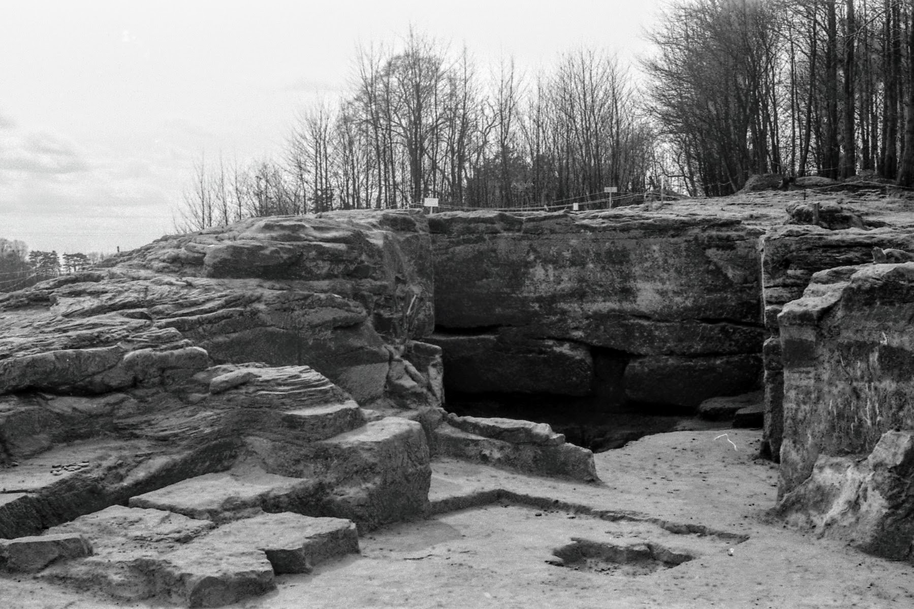
3.1 The Quarry
The task of finding the ‘walls’ was quickly accomplished. In the scrub on the north-east slope of the hill, the sandstone had been cut away to form a rectangular area of sides about 3 metres. Above the back wall, the hill rose gently to the summit. The top of the side walls was horizontal but disappeared into the floor which rose sharply up from the back wall. The floor comprised soft humus with elder trees. The Society tidied the area and it was considered by all concerned to be a quarry. In October 1971 the Warwick County Museum decided that the quarry might be more than it seemed, as there were structural features similar to those of a house in Warwick that had been built into rock, and the Society was asked to excavate. A trench was dug into the corner and along the easterly wall, down 2½ metres to natural green marl clay which ran under the rock. This depth was only attainable through the use of a tractor kindly loaned by Massey-Ferguson to dispose of the soil. The section drawn by the Society is unfortunately not available, but the finds made in the three layers, and the layer thicknesses are given below:
- Layer 1 – dark humus soil with lumps of sandstone; approximately 1 metre depth. Finds: rusty steel hawser, broken glass (modern), corrugated asbestos, small bottle with flanged top half metre down (earlier than 17th century according to Hedges), unworked flint 0.6 metres depth, clay pipe bowl 0.75 metres depth.
- Layer 2 – light brown and sandy, approximately 1 metre thick. Finds: sherd of R-B Mortarium, worked flint, red tile, bottle (17th century, Hedges), charcoal, brown and white glazed sherd at bottom of layer (Edwardian, Hedges).
- Layer 3 – coarse whitish sand and sandstone pieces, compatible with the natural sandstone of this level. Approximately 0.75 metre thick. Finds: none.
It is clear that these finds are not in simple chronological order, and it was concluded by the Society that Layers 1 and 2 were infill as a result of erosion products and humus being washed down the hill, whereas Layer 3 was the by-product of quarry working. The difference between the darker Layer 1 and lighter Layer 2 is thought to lie with a change in the vegetation on the hill. Brewer: A Topographical and Historical Description of the County of Warwickshire (undated), in referring to the inscription below the present memorial to Piers Gaveston, states “on a part of the rocky hill near the top is the following ancient inscription . . .”
This suggests that the hill was bare rock at one time. The Spanish Chestnut trees which now crown the hill, a little way above the Quarry, were only 35-40 years old (counting rings) and were thus planted after the Edwardian sherd of Layer 2. From local sources it was also learned that the Quarry had been worked early this century. Thus it is a tenable theory that after the last use, early this century, the Quarry was infilled with the lighter erosion products of Layer 2 with its miscellany of litter including the Edwardian sherd. Then the trees were planted in the 1930s leading to a humus content, Layer 1, in the erosion products.
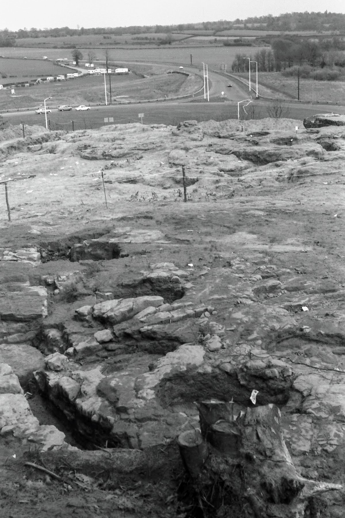
In the later stages, the Quarry was completely cleared by the Museum and its somewhat complex shape revealed, Fig. 2. The tendency to zig-zag the walls enabled the quarry-man to get at the end of the potential blocks to split them out. It is understood that the Museum found some mediaeval sherds near the mouth of the Quarry, giving an earliest dating evidence for the workings.
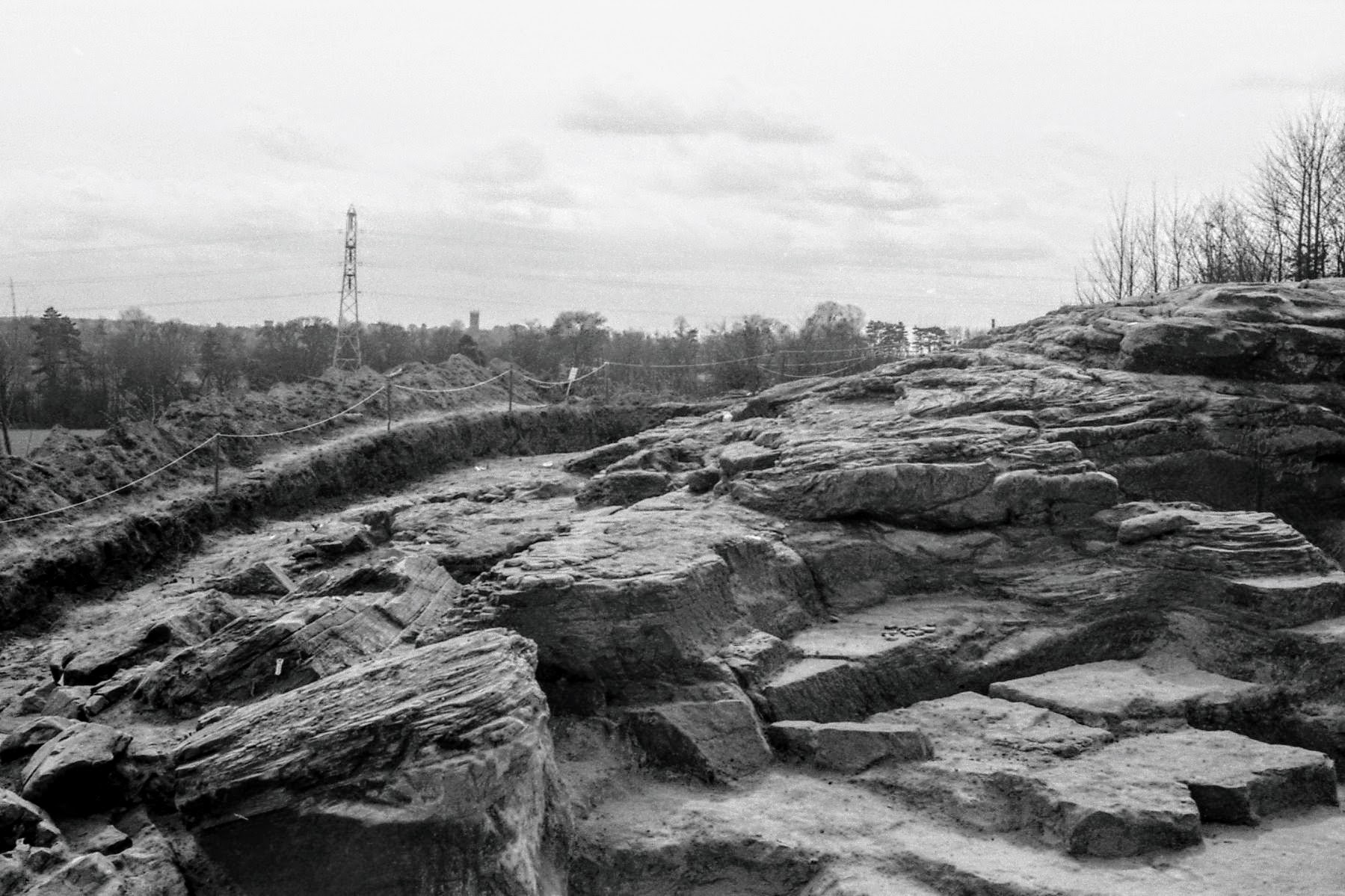
3.2 Pits and Post-Holes
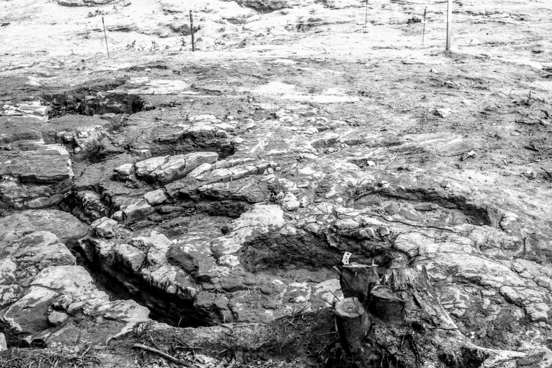
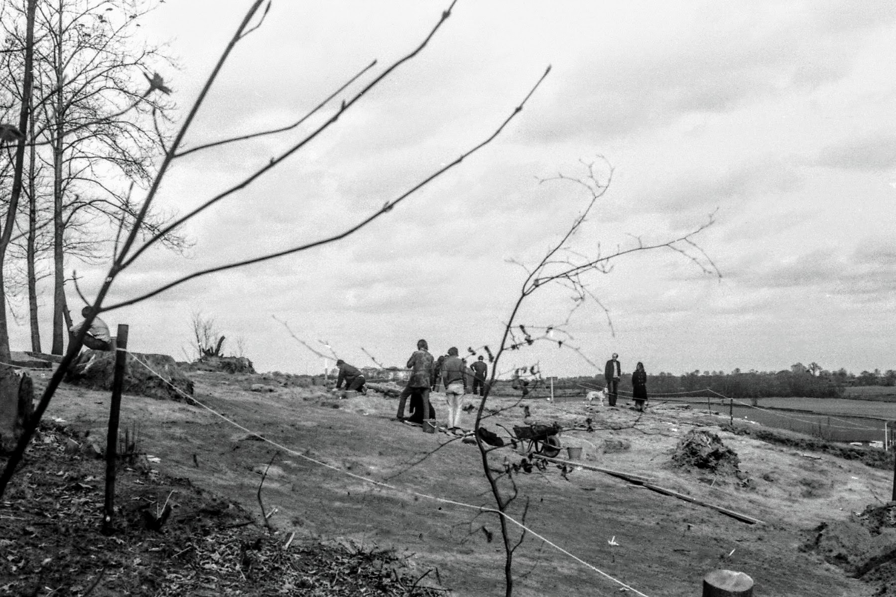
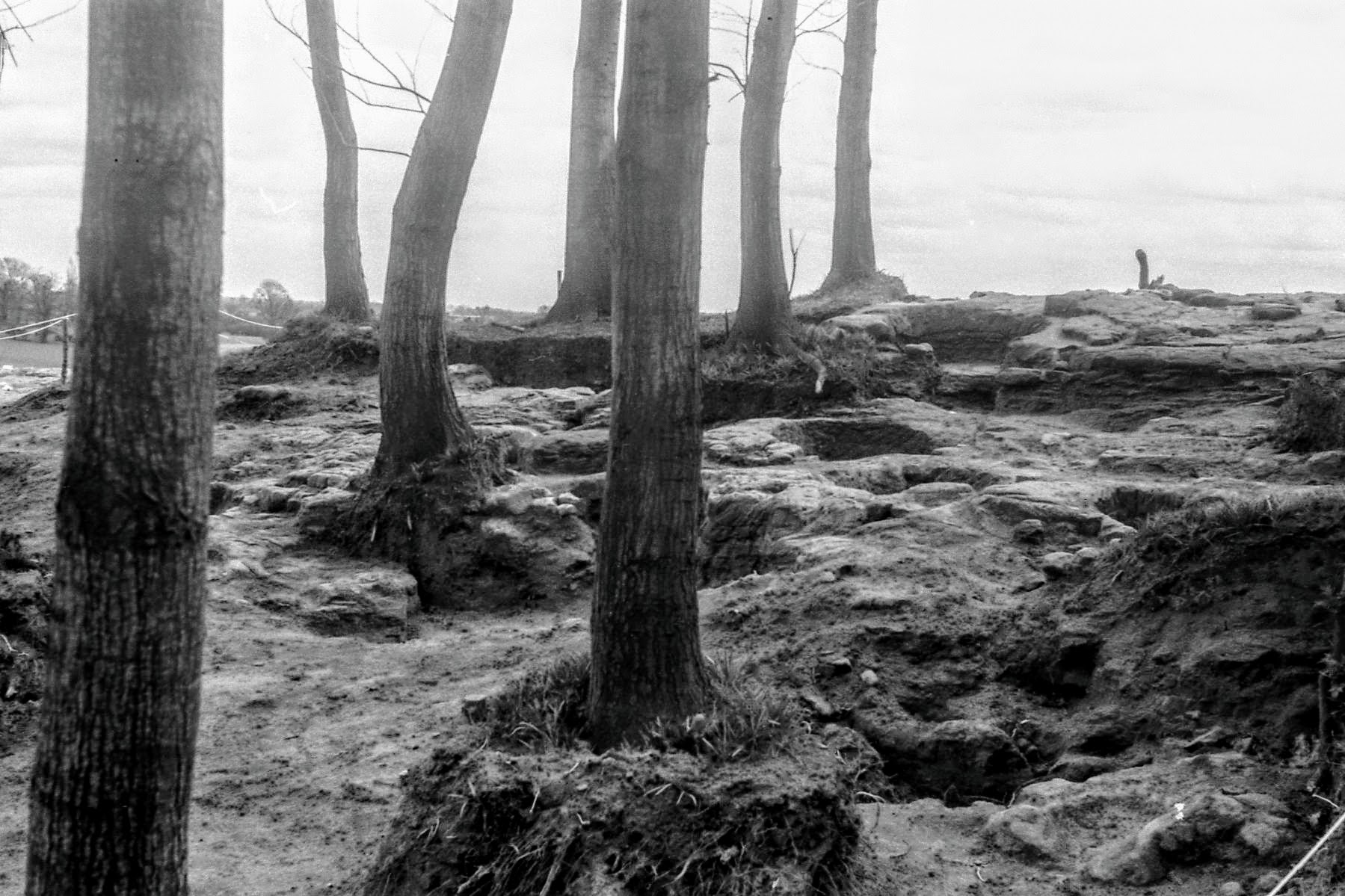
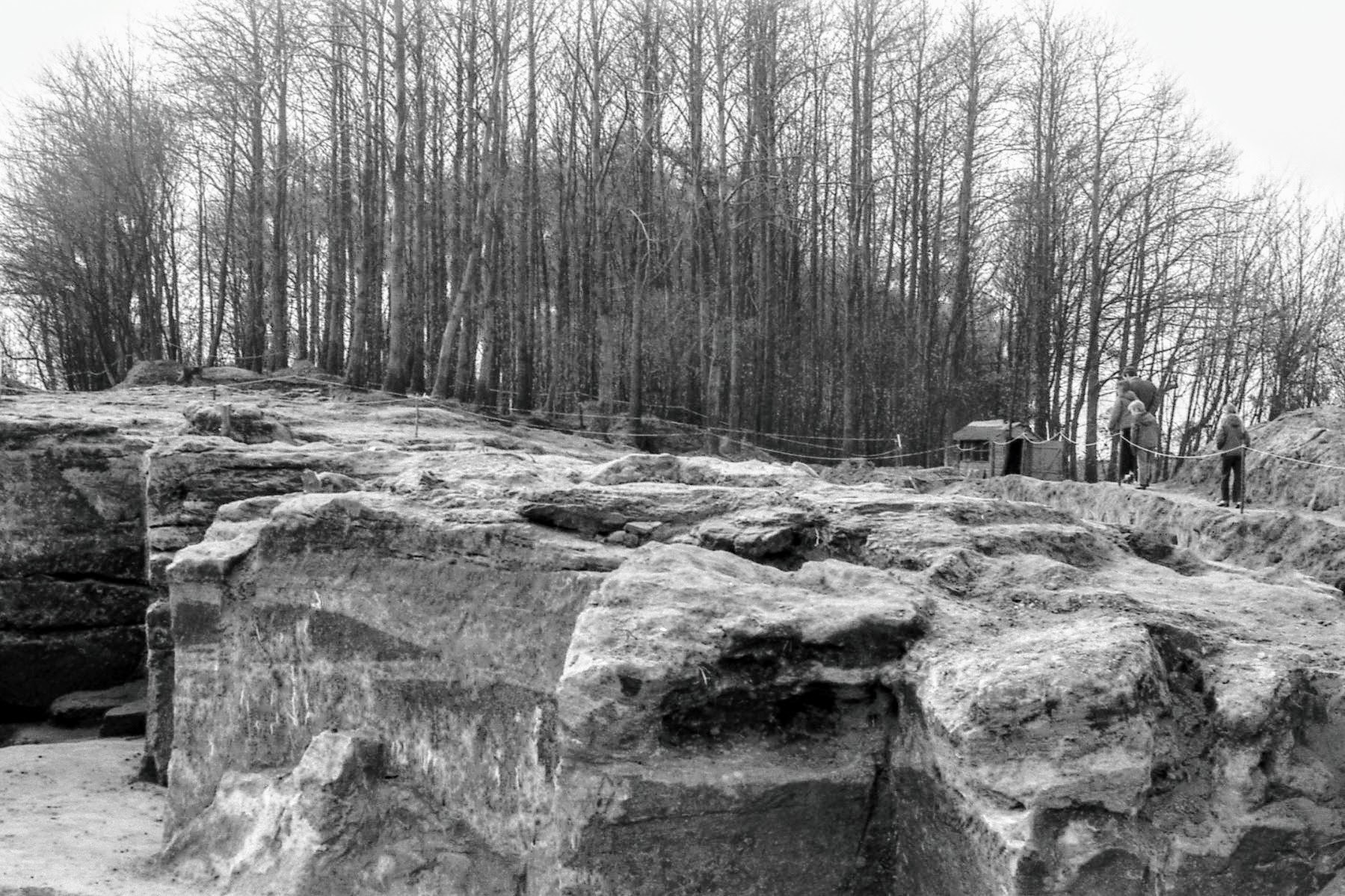
At the time work was started by the Society on the Quarry, students had been set the task by the Museum to investigate a possible barrow lying 50m up the hill from the Quarry. A trench through the 5cm or so of soil had disclosed four circular pits about 1 metre diameter cut into the sandstone. The deepest, which turned out to be the deepest on the site, was about 0.3 metres deep. Toolmarks were clearly visible on the sides – and, it was claimed by the Museum – there were signs of where the edges had been cut by ploughshares. The Society was invited to extend the area and very quickly more pits came to light, and then post-holes also cut into the rock.
For a number of weekends work continued, exposing more and more pits and a few post-holes. The technique was to scrape the soil away evenly until the top edge of a pit was disclosed. The pit was then sectioned by carefully removing the infill on one half in the hope of seeing some stratification or other indication of the purpose of the pit. Except for an occasional piece of sandstone or a flint flake, nothing was found in the uniform light grey soil. The depth of the pits varied consider-ably, some being less than 1 cm. deep, probably the result of erosion of the rock above. In all, over one hundred pits were found, with nothing to establish directly their age.
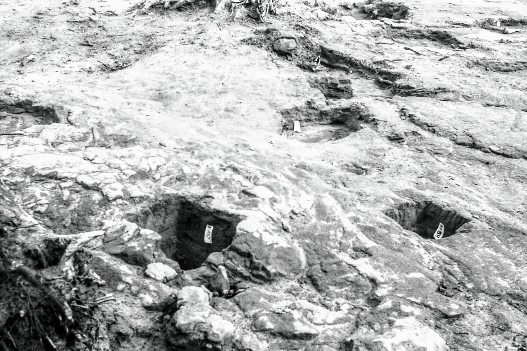
3.3 Graves
At the end of November 1971, on what was to be the very last afternoon the site would be available before the road engineers moved in, an all-out effort was mounted by the Society on the area just above the Quarry. On finding an oblong hole in the sandstone, technique was somewhat thrown to the wind and one end was opened up. At the bottom lay a human thigh bone and a rusty implement. Work was stopped immediately and the Museum contacted. The rusty object was identified as probably being a ‘scramasax’ or short Saxon sword. The Museum undertook the excavation of this grave and another found alongside in the hope of finding evidence of a shield, of which only the rivets and boss were likely to remain, but no such evidence was found. The first grave contained an incomplete skeleton including the skull, whereas the second contained lower leg bones only.It was suggested that the graves had been ravished by wolves.
The finding of these graves put a whole new complexion on the site; hitherto the Museum had tended to regard the pits and post-holes as relatively modern; as it was now possible that they were contemporary with the graves, the site became of some importance. The road engineers were persuaded to revise the line of the proposed escarpment to leave the site untouched. As already mentioned, at this point the Museum took over full control of the site. With the aid of machinery the site was exposed and in addition to further pits and post-holes, longitudinal shallow cuts on the sloping sides of the hill, like beam slots, were uncovered.
3.4 Mesolithic Flints
From the outset of work, a few worked flints had been found on site. However, during the course of excavating an area near the top of the Quarry, flints were found in the shallow soil in profusion. The Museum’s spoil heap was carefully sifted by the Society, and each barrow-load of soil was checked; a total of about 1000 flints were found, 273 in a little over one hour’s work. All these were passed over to the Directors and it is understood that a report on these is in the course of preparation.
4. Discussion of Evidence
The Author makes no apology for attempting to sum up and draw conclusions from the information that is available to him, although some of the conclusions might be overturned when all the information available comes to light.
The Quarry has already been dealt with and it may have had mediaeval origins. Much of the infill through natural causes has probably taken place this century.
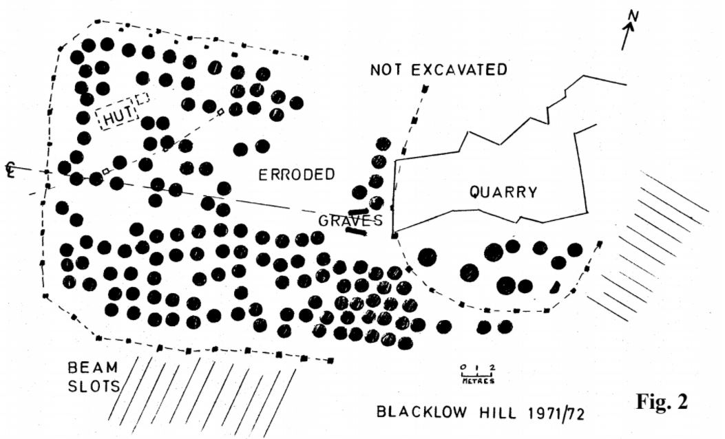
The pits, post-holes, graves and beam slots require some discussion. Fig. 2, which is based on the Site Drawing given to the Society by the Museum, shows the plan of these features related to the Quarry. An area containing more than 100 pits is enclosed on three sides by more or less evenly spaced post-holes, two sets on the north side. At the east end of this enclosure lie the two graves, and almost immediately to the east of these lies part of an apparently oval line of post-holes enclosing some larger, as well as standard, pits. Any remaining part of this enclosure lies deeply under soil over-burdened with spoil. Limited exploration by both the Society and the Museum failed to reveal any features outside the post-hole enclosures. ‘Beam slots’ run down the hill on the south and east slopes, The first question is whether these features are all associated, and the following might be deduced:
- The fact that there appear to be no pits outside the post-hole enclosure and that they are ubiquitous inside (except where the bed-rock was very eroded) leaves little doubt that the pits and post-holes are associated. The arc of post-holes running across the north-west corner of the site is regarded as spurious and later.
- The fact that the larger pits are found only within the oval enclosure tends to associate those post-holes with the complex.
- The graves lie approximately on the centre line of the rectangular enclosure and do not cut, nor are cut into by any pit or post-hole, suggesting that they are associated, but not necessarily contemporary. The area to the north of the graves is eroded, but to the south there is a relatively uneroded area which is likely to have shown up further graves, had there been any.
It is reasonable therefore to assume that the pits, post-holes and graves are associated, and on the assumption that the graves are Saxon, the complex is likely to be similarly dated. Although all the beam slots are outside the enclosure, the argument that they are therefore associated is more tenuous as they are on more sloping ground; nevertheless they are considered to be associated.
On the question of the function of the site, the most compelling evidence is the lack of artifacts – except for the mesolithic flints of a much earlier period. Even the pit and post-hole workers failed to break a pot – or if so, cleared it up. Although there is historical evidence that the hill was rocky (Brewer) there would have needed to have been an unusually high standard of housekeeping to have avoided leaving some evidence of any habitation. Hence an explanation needs to be sought in other directions. In view of the presence of the graves it is a likely possibility that it was a ritual site. In such a context the presence of an enclosure would not be unusual, but the presence of the pits, as far as the Author is aware, is unique.
Various suggestions for the need for the pits have been made, including food storage and tanning, but there has been no evidence to support these. Any ritual purpose other than perhaps for libation is not obvious,but then matters ritual seldom are. In the early days of finding the pits, a member of the Society suggested that they were for growing trees or shrubs, but at the time this was disregarded as frivolous on the grounds that, as evinced by the damage done to the bedrock by tree roots, there would be signs of this and also of vestigial tree roots. It is now accepted that many of the pits were shallow, possibly as a result of root damage; nevertheless no signs of root traces were found in the pit contents. It was certainly the Museum’s view that the site may have been a sacred Saxon Grove, and the pits were for growing bushes and shrubs.
The purpose of the pits must remain speculative, but it does seem that Blacklow Hill is an archetypal discovery and needs expert consideration.
 Blacklow Hill, Easter 1972 - no 1
5. Finale
The site has almost completely disappeared. The road engineers were forced to change the line of the escarpment after a landslide, and the Quarry and many other features were destroyed. For the remainder, despite pleas from the Society that it should be covered over again, it has been left open to erode and suffer the ravages of vegetation. That is, except for a small part including three or four of the best examples of pits which were covered over with soil by the Society. These are still protected from the elements, but are subject to damage by the nearby Spanish Chestnuts.
A claim by the Museum that the site would not have been found but for the road works is true. It is equally true that until a formal report is forthcoming, the effort and expenditure of public money will have been largely in vain. Finally it is also true that but for the persistence of the Society, and the disregard to formal techniques, leading to the finding of the graves on what was to be the last afternoon of the dig, the significance of the site, whatever this may turn out to be, would almost certainly have been lost for ever.
6. Acknowledgements
Very many people helped on this excavation, and apart from Society members, much effort was provided by pupils of the then Kenilworth Grammar School and many family groups who came to our aid. The equipment they armed themselves with was seldom that recommended for this type of work, but the work was done and well.
HLGS”
Further Reading:
- Leek Wootton & Guy’s Cliffe Community Hubsite – including a short history of Blacklow Hill.
- Detailed Plan of the Site – Harry Sunley also produced the following detailed A3 sized plan of the site showing the find sites. The lines are very fine so it is recommended that you download the image if you wish to examine it in detail:

A3 Blacklow Hill Plan

- The Official Report? Finally, in the course of putting together this From the Archives piece, we came across a PDF scan of a typed report from the dig with some annotations by hand. Could this be a draft of the formal report that was never published? The report can be found on the Historic England website and is also attached here:BLACKLOWHILLWARWICKS.THEHUMANBONE