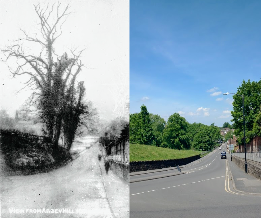
This undated view shows Rosemary Hill, taken from the junction with Upper Rosemary Hill and Abbey Hill, looking down towards Bridge Street. What’s notable about the ‘then’ image is that the bank to the left has been significantly cut back to allow road widening and to permit a slightly less challenging gradient for traffic coming up Rosemary Hill and turning into Abbey Hill in the near lane.
Robin Leach has suggested that the ‘then’ image was taken before an initial widening scheme, carried out in 1913. Robin also explains in his book The Abbey Fields (Rookfield Publications, 2017) that yet more road widening work was later undertaken at this spot, to alleviate congestion when busses stopped on Abbey Hill. The decision was taken in 1936 (see p.97 of The Abbey Fields). Following some deliberation as to whether the whole length of Abbey Hill should be widened, necessitating incursion into the Abbey Fields and the felling of several mature beech trees, it was decided that just the bus stops and the footpath would be cut into the Abbey Fields adjacent to Abbey Hill, but that the embankment beside the corner with Rosemary Hill would be cut back as shown above.
Robin records that the work was approved in 1939 and, as far as he can determine, took palace the same year.