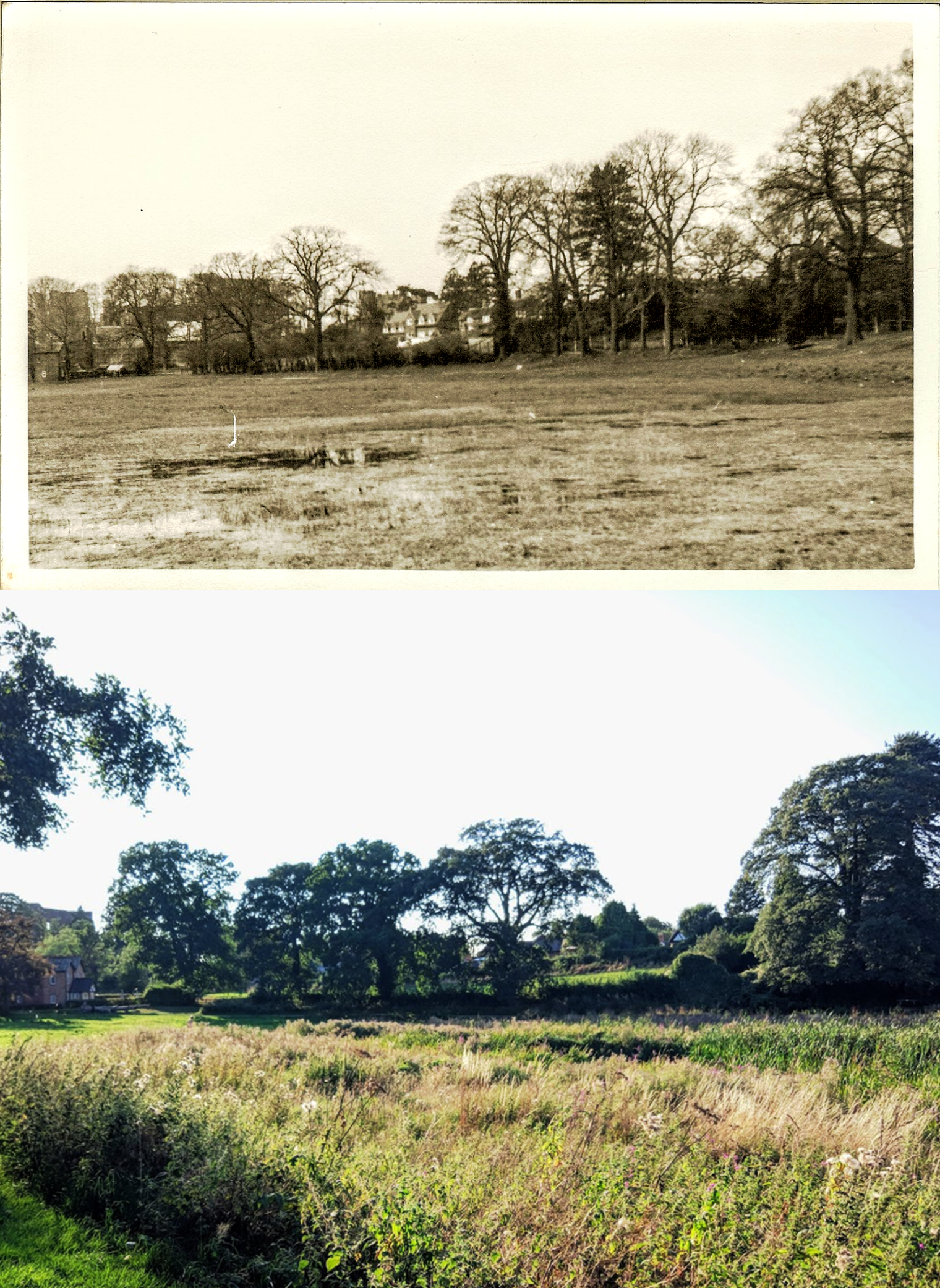
This image of Oxpen Meadow, was provided to KHAS from the collection of the late Reg Palmer. In the distance (left) is the Castle, and in front of it can be seen 38 Castle Road, beside the Ford. The meadow beneath Little Virginia can be seen to the rear. A few trees have come and gone between the dates the two images were photographed. The location of the Oxpen Meadow lake was once the site of the Abbey Pool, until it was drained in the 17th century. On the 1692 Estate Map by James Fish it is marked as ‘The Abbey Meadow’.
The ‘then’ image shows what is now the western end of the lake in the Abbey Fields, but the photograph was taken before it was permanently re-flooded. The lake in the ‘now’ image is in fact flooded, albeit the water is not immediately visible due to the length of the waterside vegetation, grasses and reeds. Ironically, there is more water on show in the ‘then’ image due to the often waterlogged ground that used to plague the area, preventing it from being used for anything particularly meaningful. This was evidently a factor in the decision to reflood the area.
Harry Sunley recorded in A Kenilworth Chronology (Odibourne Press, 1989) that the council approved the flooding of the Oxpen Meadow for skating in December 1930. Shortly afterwards, Harry also records that the hillside sloping down to the Oxpen Meadow was gifted to the council by its owner Gertrude Evans in 1933.
Robin Leach’s Abbey Fields timeline adds that the meadow was first flooded for skating in 1879, and re-flooded as a wartime water supply in 1940. By 1948 it was drained again and used for an agricultural show. The decision to flood the meadow permanently came in 1997.
The Oxpen Meadow is also known to some by the alternative name of Joe’s Overflow.